


LOWER MANHATTAN COASTAL RESILIENCE
NEW YORK CITY, NY

New York City, like many other cities around the world, is facing the complex reality of climate change and its severe impacts on the urban environment. In October 2012, Hurricane Sandy hit New York City, flooding 17% of the city’s land, claiming 44 lives, and causing $19 billion in damages and lost economic activity. Storm surge reached a record 14 feet high in New York Harbor, and the hurricane caused power outages across the city that impacted over 2 million New Yorkers, some lasting for weeks or longer. In Lower Manhattan (the “District”), the impact of Hurricane Sandy was extreme, causing two deaths and affecting thousands of homes. This Lower Manhattan Climate Resilience Study builds on past efforts and leadership by the Lower Manhattan communities and the City after Hurricane Sandy, and lays the path forward
for the next phase of climate resilience planning for Lower Manhattan’s future.
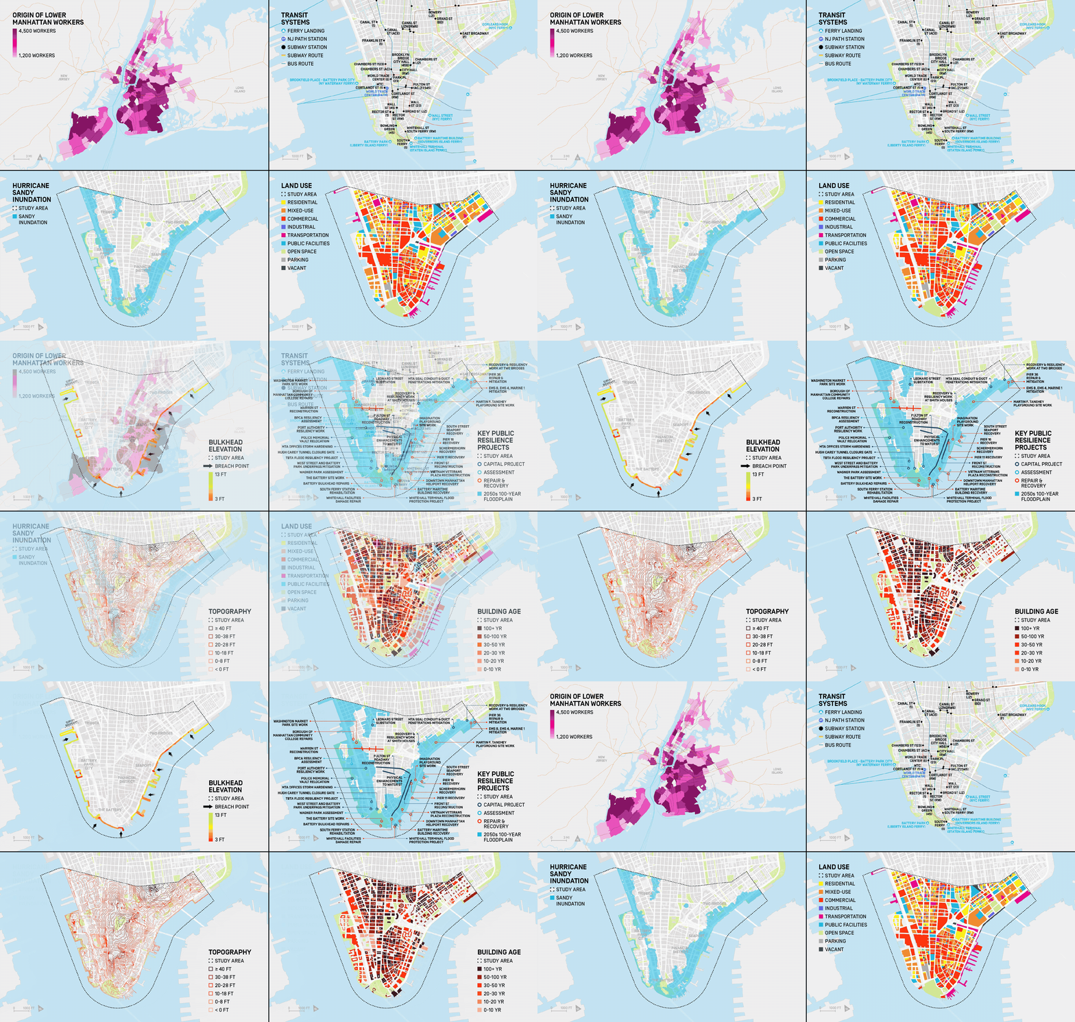

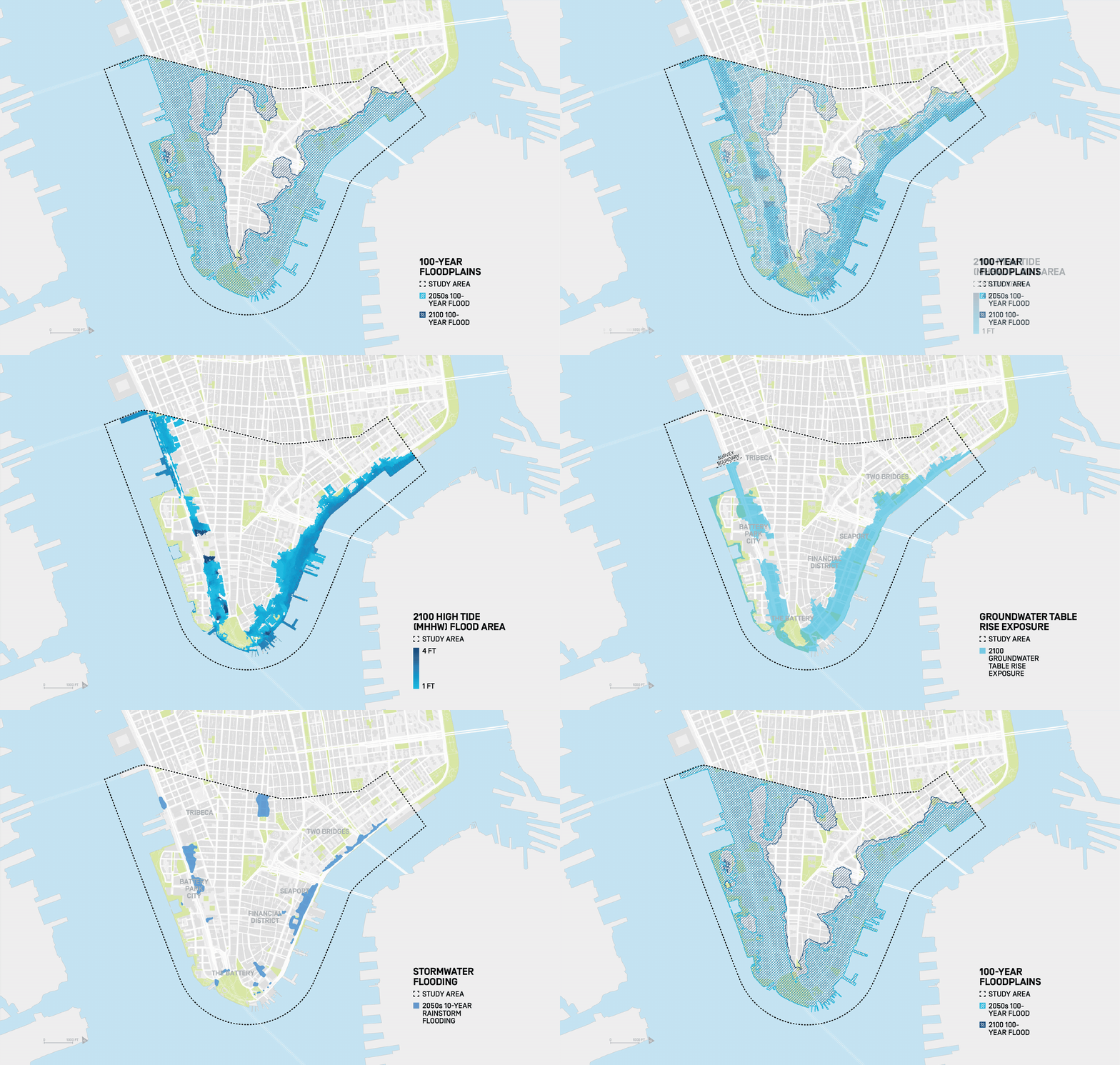
The City's resilience strategy incorporates targeted, ambitious investments that will deliver significant climate adaptation for key neighborhoods of Lower Manhattan - Two Bridges,
the Battery, Battery Park City, and the Seaport - in the near future. These projects prioritize achieving protection from climate hazards while also mitigating negative impacts on the
public realm and integrating co-benefits for the residents and workers of Lower Manhattan.


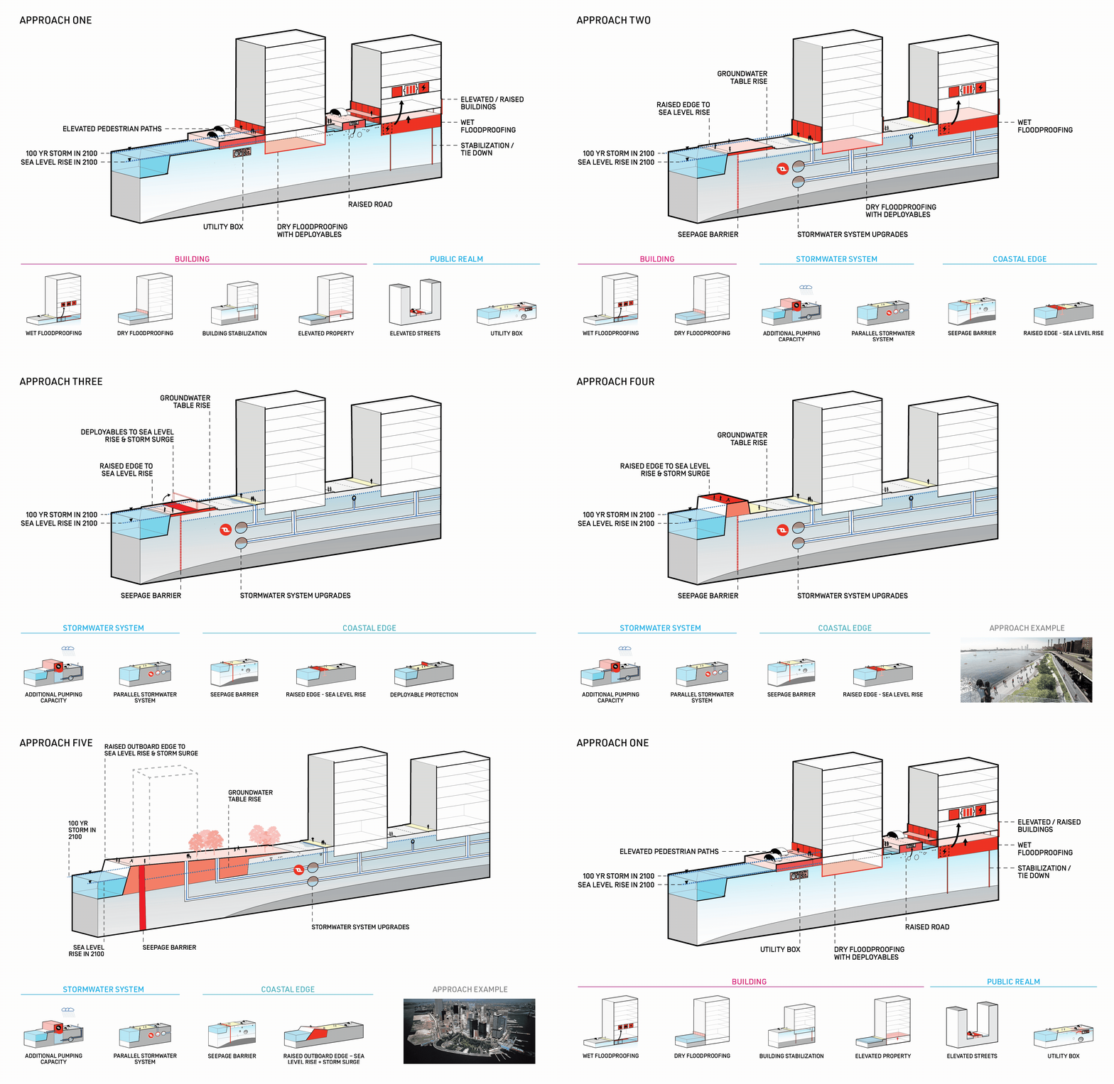
Adaptation will address acute storms and chronic change at the same time. No single intervention can protect a district this complex. The study assembled a flexible toolkit spanning buildings, streets, utilities, stormwater systems, and the coastal edge.

The City is already making strides not only to assess the future impacts of climate change, but also to plan for them proactively. With the findings of this study, the City is advancing an overall climate resilience strategy for Lower Manhattan. This strategy integrates necessary actions to adapt to climate risks in the near term, with the innovation and flexibility needed to continue preparing.

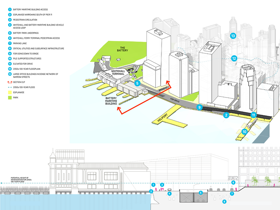
The strategy translates the toolkit into a phased portfolio of projects, matching protection measures to each neighborhood’s topography, infrastructure constraints, and public-realm opportunities. Near-term investments advance where action is feasible today, while more constrained areas continue toward long-term planning. In the Financial District and Seaport, low elevations, narrow streets, historic structures, ferry access, utilities, tunnels, and the FDR Drive leave little room for conventional flood protection. Here, the study identifies shoreline extension and outboard protection as a necessary long-term pathway for creating resilient ground, public space, and future capacity.

Client:
Mayor’s Office of Recovery and Resiliency (ORR), NYC Economic Development Corporation (EDC), Governor’s Office of Storm Recovery
Collaborators:
AECOM, HR&A Advisors, Bjarke Ingels Group, One Architecture, James Lima Planning + Development
Status:
Study completed